The RiverConnect Environment

The natural environment is the part of the environment that is the result of natural processes. Examples of these natural processes include photosynthesis, evaporation, erosion, reproduction and deposition.
This section contains resources about the natural RiverConnect environment including the Aboriginal significance of the area, sustainability, the human impact on the area and land management.
Understanding evironments and sustainability
-
The Natural Environment is that part of the environment that is the result of natural processes. Examples of these natural processes include photosynthesis, evaporation, erosion, reproduction and deposition.
-
Sustainability basically refers to a holistic approach with aims such as preserving natural and non-renewable resources and intergenerational equity.

Aboriginal significance of the RiverConnect area
-
A story by Betty Lovett taken from 'Living Aboriginal History of Victoria' by Jackomas and Fowler. Publisher Cambridge.
-
Scanned map of Missions and Reserves, 1971.
-
Features of traditional Aboriginal life prior to colonisation.
The natural environment of the RiverConnect area
Australian rivers are the most striking feature on our landscape. They are home to an array of flora and fauna. The water they contain is vital for our community. Australian streams are unique in terms of their morphology, sedimentology, their flora and fauna.
-
By Wayne Tennant, GBCMA
-
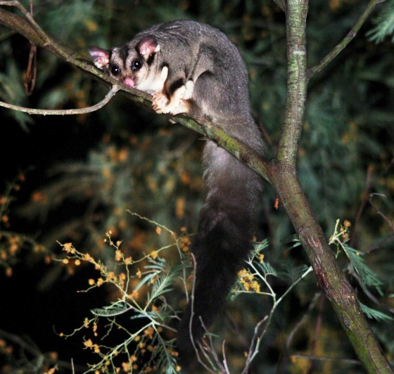
Mammals, birds, reptiles, amphibians and fish around Reedy Swamp Wildlife Reserve and surrounding areas.
-
Vegetation along the Goulburn River floodway, inclusive of Reedy Swamp Wildlife Reserve.
-
Ecological Vegetation Classes (EVCs) is a classification system developed by the Victorian Government Environment Department (then know as the NRE) for mapping and management planning of native vegetation in Victoria. EVC classes describe the variation in vegetation composition and structure, relative to local environmental variation in landscape position, drainage, soils, aspect and elevation, etc.
-
Compare the EVC in 1750 to the 2005 map below - what a difference!
-
Compare the 2005 EVC map to how the landscape was in the 1750's

Human impact
-
Specific local issues of concern. For more information, see "Land Management".
Land Management in your Reach
Most of the crown land within the RiverConnect area is now either part of the Lower Goulburn National Park or part of the Shepparton Regional Park. It is therefore under the management authority of Parks Victoria and Yorta Yorta Nations as part of the co-management agreement of the State Government of Victoria.
There are some still areas that are under the management the Greater Shepparton City Council and some minor areas remaining under the management of the Department of Sustainability and Environment.
In addition the Goulburn Broken Catchment Management Authority has a role as the caretaker of river health in the Goulburn Broken catchment. In fulfilling this role they carry out works on rivers and the river banks and work in partnership with the appropriate land managers to ensure the health of the waterways are maintained and where possible enhanced
To find out who is responsible for your reach, download the files below or contact the RiverConnect Education Project Officer.
Wanting to do something to help improve the environment?
Permission to do “on ground works” is required. View the Forms and permissions page for more information.
-
Gallery of photos depicting issues facing land management in the RiverConnect area.
-
The Victorian Government has made several important decisions to ensure the long-term protection of the red gum region and continued sustainable social and economic activities.
-
Native Vegetation Management: A Framework for action was released in 2002. It is the State Government’s strategy to protect, enhance and revegetate Victoria’s native vegetation.
Management Plans
Land Managment Plans relevant to RiverConnect and the Environment can be found on our Management Plans page.
